![[Hoodoos in Island in the Sky]](images/trip99/hoocyn.jpg)
![[Hoodoo closeup in Island in the Sky]](images/trip99/hoodoo.jpg) Most Hoodoos (capped rock structures -- the upper layer contains more lime
and is more resistant to erosion than the soft red sandstone beneath it,
and so protects the column somewhat from erosion) are farther south,
in the Needles district of Canyonlands, but there were a few in
Island in the Sky. This was a nice collection.
Most Hoodoos (capped rock structures -- the upper layer contains more lime
and is more resistant to erosion than the soft red sandstone beneath it,
and so protects the column somewhat from erosion) are farther south,
in the Needles district of Canyonlands, but there were a few in
Island in the Sky. This was a nice collection.
![[Washerwoman Arch through Mesa Arch]](images/trip99/mesaarch.jpg)
![[Foot of Mesa Arch]](images/trip99/mesafoot.jpg) Mesa Arch is probably the best arch in Island in the Sky (though not as good
as those in Arches National Park).
A famous photograph is to shoot Washerwoman Arch looking through Mesa Arch.
This can be spectacular if the lighting is right -- ideally, you want a beam
of sunlight coming through the clouds to illuminate Washerwoman and make
her stand out against the other rock features nearby.
Mesa Arch is probably the best arch in Island in the Sky (though not as good
as those in Arches National Park).
A famous photograph is to shoot Washerwoman Arch looking through Mesa Arch.
This can be spectacular if the lighting is right -- ideally, you want a beam
of sunlight coming through the clouds to illuminate Washerwoman and make
her stand out against the other rock features nearby.
Not having the patience for this, I snapped a picture in the light available
to me at the time (left). At right, you can see how precariously one side
of Mesa Arch is held, and the steepness of the drop behind it
![[Hoodoo pillars]](images/needles/pillars.jpg)
![[tafoni]](images/needles/tafoni.jpg) Our first stop in the Needles district was a roadside stop showing some
impressively layered hoodoo pillars, and walls of tafoni -- sandstone
sculpted by wind erosion into fanciful patterns.
Our first stop in the Needles district was a roadside stop showing some
impressively layered hoodoo pillars, and walls of tafoni -- sandstone
sculpted by wind erosion into fanciful patterns.
![[]](images/needles/pothole.jpg)
![[]](images/needles/crypto.jpg) We took a short hike on the "Pothole Trail", a slickrock surface where
life begins in potholes, either as a plant colony beginning as
cryptobiotic soil (the lumpy black stuff in the foreground of the
right picture) or as tiny dehydrated fairy shrimp (left) which come to life
during the rainy season, grow, mate, lay their eggs and die before
the coming of the next dry season.
We took a short hike on the "Pothole Trail", a slickrock surface where
life begins in potholes, either as a plant colony beginning as
cryptobiotic soil (the lumpy black stuff in the foreground of the
right picture) or as tiny dehydrated fairy shrimp (left) which come to life
during the rainy season, grow, mate, lay their eggs and die before
the coming of the next dry season.
![[little elephant rock]](images/needles/elephant.jpg)
![[Mt Rushmore]](images/needles/rushmore.jpg) The Pothole Trail also had some wonderful rock formations on it,
like this little elephant.
The Pothole Trail also had some wonderful rock formations on it,
like this little elephant.
But we didn't expect to find Mt Rushmore in Southern Utah!
![[Newspaper Rock]](images/needles/newspaper.jpg) Newspaper Rock, perhaps the most famous of all Indian petroglyph sites,
sits beside the road leading in to the Needles.
Indians of many tribes spanning perhaps thousands of years carved
pictures into the desert varnish covering this rock.
The carvings range from abstract spirals and suns, and squiggles
which might be snakes or might simply be abstractions, through animals
(lots of flying squirrels and bighorn sheep, turtles, herds of reindeer)
to people -- normal people, people with horns or other animal features,
and people riding horses, to actual writing obviously added by
modern visitors. (The fine for writing on the wall is $200.)
The signboard beside the wall is refreshingly honest: basically,
that there are lots of theories but no one really knows what any of it means.
Newspaper Rock, perhaps the most famous of all Indian petroglyph sites,
sits beside the road leading in to the Needles.
Indians of many tribes spanning perhaps thousands of years carved
pictures into the desert varnish covering this rock.
The carvings range from abstract spirals and suns, and squiggles
which might be snakes or might simply be abstractions, through animals
(lots of flying squirrels and bighorn sheep, turtles, herds of reindeer)
to people -- normal people, people with horns or other animal features,
and people riding horses, to actual writing obviously added by
modern visitors. (The fine for writing on the wall is $200.)
The signboard beside the wall is refreshingly honest: basically,
that there are lots of theories but no one really knows what any of it means.
![[Wilson Arch]](images/trip99/wilson.jpg) Wilson Arch is one of the more impressive arches in Utah -- and part of
what's impressive about it is that it's just sitting by highway 191
approaching Moab from the south.
No park, no entrance fee, no rules, just look, explore, enjoy.
Wilson Arch is one of the more impressive arches in Utah -- and part of
what's impressive about it is that it's just sitting by highway 191
approaching Moab from the south.
No park, no entrance fee, no rules, just look, explore, enjoy.
![[Dave at Wilson Arch]](images/trip99/wilson-dave.jpg) You can hike right up to it. See Dave standing at the base on the right?
You can hike right up to it. See Dave standing at the base on the right?
![[Base of Wilson Arch]](images/trip99/wilsonbase.jpg)
![[looking downriver]](images/blackcyn/black-east.jpg)
![[another downriver view]](images/blackcyn/blackcyn1.jpg) The rock of the Black Canyon is very hard, very black, and very steep.
The Gunnison, at the bottom of the chasm, was bright green in this late
fall season.
The rock of the Black Canyon is very hard, very black, and very steep.
The Gunnison, at the bottom of the chasm, was bright green in this late
fall season.
Notice, particularly in the picture on the left, the difference between
the slopes of the two sides of the canyon. This photo was taken facing
eastward; the south wall of the canyon stays colder in winter, and
develops more ice, which then causes fractures in the wall, leading to
greater erosion in that wall and a more gradual slope. The better-lit
north wall stays freer of ice and holds its steep slope.
![[Painted Wall]](images/blackcyn/painted.jpg)
![[upriver and Painted Wall]](images/blackcyn/black-west.jpg) Pegmatite dikes make huge pink streamers through the otherwise mostly black
walls of the canyon. Up close, the pegmatite looks almost like rose quartz.
There are also intrusions of granite and mica schists. The "Painted Wall"
(left) is the best display of patterns in the north wall of the canyon.
Pegmatite dikes make huge pink streamers through the otherwise mostly black
walls of the canyon. Up close, the pegmatite looks almost like rose quartz.
There are also intrusions of granite and mica schists. The "Painted Wall"
(left) is the best display of patterns in the north wall of the canyon.
| Big chunk of Obsidian near Mono Craters: |
![[Big chunk o' glass]](images/trip99/obsidian.jpg)
| ||
|---|---|---|---|
| Between Bryce and Capitol Reef: |
![[Rock layers somewhere between Bryce and Capitol Reef]](images/trip99/layers.jpg)
|
|
![[]](images/trip99/cowtraffic.jpg)
|
| Moab: |
![[Kayaking spot on the Colorado river]](images/trip99/colorado1.jpg)
|
![[Kayaking spot on the Colorado river]](images/trip99/colorado2.jpg)
|
![[Cool campaigning in Moab]](images/trip99/councilman.jpg)
|
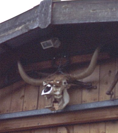
| Denver: | Cool cow skull |
![[Red Rock Canyon, just west of Bryce]](images/trip99/redrockcyn.jpg)
|
| White Rim Panorama: |
![[White Rim]](images/trip99/whiterim1.jpg)
|
![[White Rim]](images/trip99/whiterim2.jpg)
|
![[White Rim]](images/trip99/whiterim3.jpg)
|
|---|